- DMV Weather
- Posts
- Sunday winter storm update: less snow, more ice
Sunday winter storm update: less snow, more ice
Rudie Verougstraete
January 22, 2026
There are some major changes to the forecast for this Sunday’s winter storm…models have shifted the track further north, allowing warmer air aloft to change snow over to sleet then freezing rain Sunday morning or around noon (depending on which model you look at). Either way, ice accumulations of up to 3/4” are possible by Sunday night, again, followed by extreme cold the rest of the week, with lows in the low teens and some single digits and highs only in the mid to upper 20s. Because of the change to sleet and freezing rain, snow accumulations are lowered to 7 to 10 inches in the Richmond area, with the heaviest snow bands shifted up towards Fredericksburg, Charlottesville, and D.C. where a foot or more is still likely.
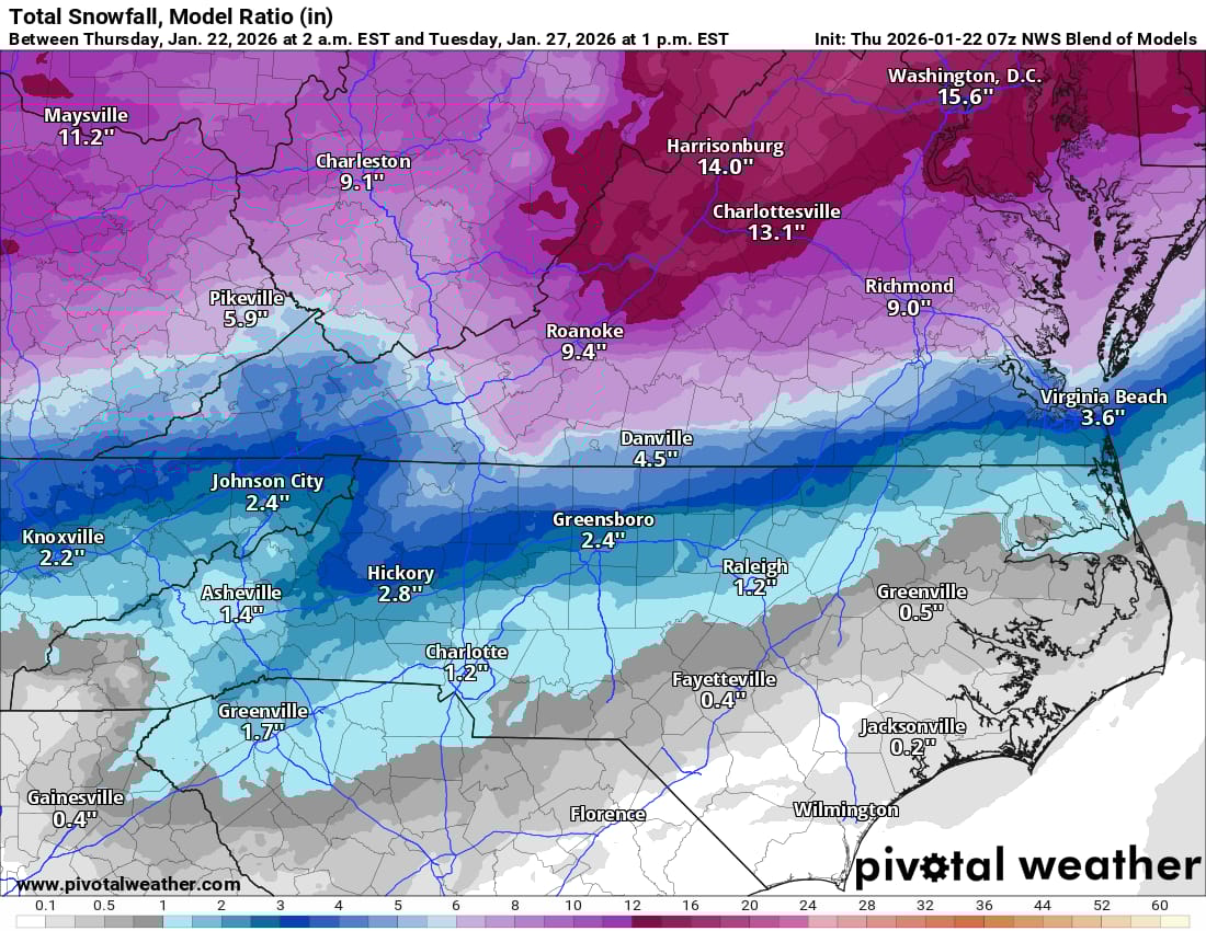
Thursday morning average of all the forecast model projections for Sunday
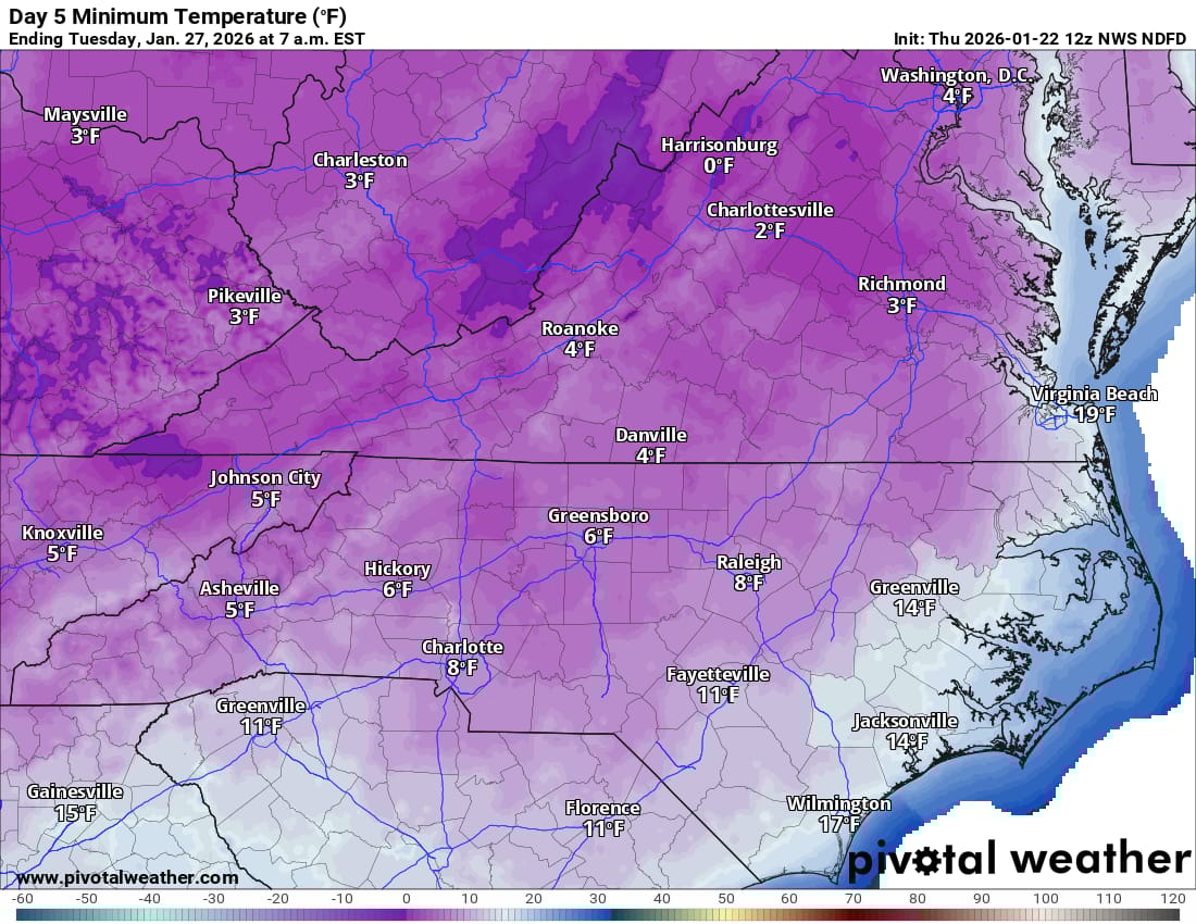
Tuesday morning temperatures